




Most airport terminals were built decades before anyone thought about digital models. The drawings on file usually don't match what's actually behind the ceiling tiles or under the floor slab today. Every renovation, tenant fit-out, and system upgrade since then has added another layer of undocumented change. When architects, structural engineers, and MEP teams sit down to plan a terminal expansion, they are often working from records nobody can fully trust.
This is exactly the gap scan to BIM services are built to close.
Airports operate under constraints most buildings never face. Security clearances limit access, and passenger flow can't stop for construction crews. A coordination mistake found late costs more because there's no room to shut a concourse down and start over. Getting an accurate picture of existing conditions before design begins is the foundation everything else in the project depends on.
Understanding Scan to BIM for Airport Projects
Reality capture for airports typically combines terrestrial laser scanning, mobile LiDAR, and sometimes drone photogrammetry to build dense point clouds of terminal interiors and technical spaces. High-density laser scanning services can achieve millimetric accuracy across expansive halls, while compact scanners get into tight service rooms.
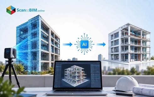
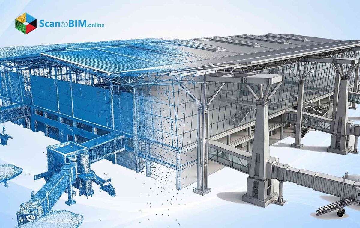
Once captured, scan data goes through a registration process that ties every point to one coordinate system, often linked to the airport's own survey control. Modelers then import that registered data into Revit, Civil 3D, or other IFC-capable platforms to trace walls, columns, ductwork, and equipment. This is where laser scan data to Revit BIM models actually take shape, turning millions of raw points into structured, usable geometry.
Laser scanning for airports looks different from a typical building project. Point cloud to BIM for airports usually covers four distinct zones:
- Terminal public areas, including check-in halls, security lanes, and departure lounges
- Back-of-house plant rooms and equipment mezzanines packed with MEP and fire protection systems
- Baggage handling galleries and utility tunnels where conveyors cross structural and mechanical lines
- Airside areas near gates and boarding bridges, where clearance envelopes must stay exact
The scale involved is real. The volume of data shows why airports need a structured process rather than a handful of spot surveys.
These models don't sit unused once they're built. Building Information Model is a shared digital representation that planners, designers, and operators can all draw from. When scan to BIM creates that representation from verified reality capture, it becomes the reference point every discipline coordinates against, forming the backbone of BIM coordination for airport projects.
Why Airport Infrastructure Is Difficult to Coordinate
Models only add value once teams understand what they're coordinating against. Airport terminals pack an unusual number of systems into a tight footprint, and that density is the first challenge any project team runs into.
High systems density and multi-discipline overlap
Terminals cram several systems into the same ceiling plenums and vertical shafts. All of the following compete for the same limited space:
- HVAC, drainage, and fire protection
- Electrical power, lighting, and communications
- Security, baggage handling, and vertical transportation
- Retail fit-outs and wayfinding
This overlap makes clashes almost guaranteed wherever two systems cross paths. Peer-reviewed research on airport BIM implementation confirms that long project cycles and multiple specialties raise the risk of constructability problems without integrated coordination. Legacy paperwork makes this overlap even harder to manage.
Legacy documentation and brownfield conditions
Most large airports were built before BIM adoption became standard practice. Since then, records have drifted away from reality in a few consistent ways:
- Original drawings exist only in 2D format
- Renovations and system upgrades aren't always logged
- Tenant fit-outs change layouts without formal documentation
ACRP Synthesis 70 notes that incomplete facility information raises the cost of owning and operating airport facilities. Designers working off outdated drawings risk routing new systems into space already occupied by undocumented supports or utilities. Even where documentation is solid, verifying it on site brings its own set of problems.
Operational and security constraints
Airports rarely pause operations for construction crews to do their work. A few restrictions shape almost every scan and survey schedule:
- Security protocols and badging requirements limit who can access a space
- Sterile and airside zones stay restricted to cleared personnel only
- Scanning and surveying work often gets pushed into overnight windows
ACRP guidance on BIM beyond design notes that information collection, including reality capture, has to work around airport governance and security classifications. Physical access isn't the only complication either. The sheer number of people who need information from the same model adds another layer entirely.
Scale, stakeholders, and decision complexity
Airport programs answer to a long list of people, each with different needs from the same set of information:
- Owners and airport operators
- Airlines and concessionaires
- Regulatory authorities
- Designers, contractors, and system vendors
ACRP Report 214 points out that airports need defined data standards and information exchange requirements across projects, precisely because no single discipline drawing can serve every stakeholder at once. This is the environment scan to BIM services were built to work in.
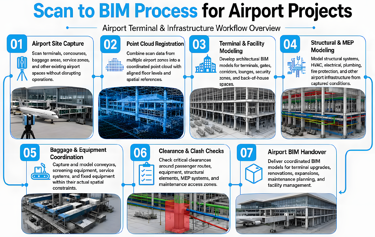
How Scan to BIM Supports Airport Infrastructure Coordination
Scan to BIM starts by replacing guesswork with verified geometry, directly addressing the documentation gaps covered above.
Accurate existing conditions modeling as a foundation
Point cloud to BIM workflows convert laser scan data into structured models covering:
- Architectural elements such as walls, slabs, and columns
- Structural framing, beams, and load-bearing elements
- MEP systems including ductwork, piping, and cable trays
Once existing conditions modeling is in place, teams have something real to check every new decision against. That verified geometry then becomes the input for clash detection across every discipline.
BIM coordination and clash detection supported by scan-based models
Coordination teams build federated models in tools like Autodesk Navisworks once verified geometry is available. These models combine existing conditions with proposed design, and results from real airport projects show the value:
- In Chongqing Jiangbei Airport's T3A terminal project, 215 geometry clashes detected through BIM, with 92 percent rated significant to construction
- The same project's 2D CAD review surfaced 357 warnings, far fewer of which flagged serious geometry conflicts
These numbers explain why catching conflicts inside the model matters more in airports than almost anywhere else. That same accuracy carries directly into MEP work, where clearances stay tightest.
Supporting MEP coordination services in airports
MEP coordination services for airports depend on knowing exactly where existing ductwork, piping, and cable trays sit before anything new gets added. Scan to BIM for MEP coordination gives engineers:
- Reliable as-built geometry for every existing system
- A verified reference to test new routing against real clearances
- Early visibility into conflicts, well before fabrication begins
With coordination handled at the design stage, the next question airport teams care about is what this actually delivers.
Benefits of Scan to BIM for Airport Infrastructure
Fewer clashes on paper mean fewer surprises on site, and that shift shows up across four measurable areas.
Reduced clashes and rework
Structured BIM workflows cut conflicts through a consistent sequence:
- Discipline-specific modeling
- Federated model review
- Clash testing and classification
- Iterative resolution before construction starts
In an airport environment where field access is limited, catching a clash inside the model instead of on site avoids delays that ripple across an operating terminal.
Cost and schedule improvements
Avoided clashes translate directly into money and time saved:
- One infrastructure project saved close to 20 percent of contract value through BIM-based clash resolution
- Those savings came from avoided change orders and reduced delays
- ACRP guidance links accurate models to more reliable lifecycle cost planning
Scan to BIM strengthens these outcomes by grounding models in real geometry rather than assumptions carried over from old drawings.
Improved design quality and constructability
Better geometry means better design decisions before construction even begins. Designers can try out:
- Duct routing proposals vs point cloud based models
- Clearances for pipe and cable tray prior to installation
- Structural load paths relative to verified as-built conditions
A study on the Techo International Airport project showedthat the use of BIM resulted in fewer changes to the drawings, a shorter construction schedule and a lower degree of difficulty in the overall construction process. Those gains depend on the model being accurate, which is exactly what reality capture services provide.
Enhanced stakeholder communication and collaboration
Accurate models change how stakeholders talk to each other. Instead of interpreting flat 2D drawings, teams can:
- Review a 3D model together in real time
- See immediately how a proposed change affects daily operations
- Combine BIM with GIS data to evaluate air navigation clearances and hazards
With that visibility established, the same value carries directly into renovation work, where existing structures create even tighter constraints.
Scan to BIM for Airport Renovation and Modernization
Most airport work today isn't new construction, it's terminal modernization inside a structure that already exists. That reality changes what teams need from a model before they touch a single wall.
- Brownfield renovation and terminal upgrades
- Terminal modernization projects usually focus on:
- Upgrading passenger processing and security checkpoints
- Modernizing retail spaces and comfort areas
- Reusing existing structural shells wherever possible
Scan to BIM captures conditions legacy drawings never recorded, including ceiling plenum congestion, structural limits, and utility runs added during past upgrades. Naples Capodichino International Airport's departures expansion used this approach, building architectural and structural models alongside 4D and 5D schedules grounded in accurate existing geometry. Los Angeles International Airport followed a similar path, integrating LiDAR data into Revit, Civil 3D, and BIM 360 to manage construction risk in a live terminal.
Integration with baggage and utility systems
Baggage handling and utility networks carry their own coordination risks:
- Conveyor routes crossing structural elements
- Utility lines running through occupied corridors
- Undocumented structural supports
Point cloud to BIM conversion embeds this information into coordination models, supporting the same hazard and clearance analysis used in BIM-GIS research for airport construction management.
Phasing and construction sequencing support
The renovation is being done in phases so that operations can continue. Accurate models allow:
- 4D schedule with actual existing geometry
- Phasing simulations of real interfaces of new work with existing work
- Lower risk of conflict between construction zones and live terminal areas
Navisworks was used to directly relate geometry to schedule and cost in the Naples expansion case. This process produced phasing models grounded in real conditions rather than assumptions.
Support for long-term operations and asset management
- Scan-derived models keep delivering value after handover:
- Verified asset inventories for maintenance planning
- Spatial data for facility management strategies
- A baseline for future capital improvement cycles
This same accuracy is what airport teams rely on when practical coordination challenges surface next.
Common Challenges and How to Overcome Them
Deploying laser scanning services inside an airport isn't as simple as showing up with equipment. Security protocols, badging, and restricted access to sterile and airside zones can limit scan coverage or force work into narrow time windows. A few practical steps help manage this:
- Coordinate scan windows with security and operations teams early, before scheduling begins
- Break scan scopes into segments matching capital improvement phases and operational zones
- Define security classifications and data handling rules directly in the BIM execution plan
Following this approach keeps reality capture services from becoming an afterthought squeezed into leftover time.
Large terminals generate enormous point cloud datasets, and Changi Terminal 2's 23,000-plus scan setups show just how much data one project can produce. Teams manage this scale through a few methods:
- Using hierarchical zoning and worksets inside BIM authoring tools
- Sharing data through cloud-based viewers and common data environments instead of duplicating massive files
- Applying automated point cloud alignment to cut down on manual registration work
Choosing the right Level of Development matters just as much as managing file size. Overly detailed models slow everyone down, while models that are too sparse leave coordination gaps. Evidence from airport BIM practice points to a workable pattern:
- LOD 300 for architecture and structure in existing conditions models
- LOD 200 to 300 for existing MEP systems, covering major routes and equipment
- LOD 350 to 400 for new MEP and airport systems supporting prefabrication and asset management
Federated models on complex airport projects can generate hundreds of clashes, and not all of them matter equally. A clearer approach helps teams focus, building clash matrices by discipline pair, ranking issues by severity and cost impact, and feeding lessons learned back into future execution plans. When existing conditions come from verified scan data, surfaced clashes reflect real problems worth solving. ACRP guidance treats BIM as an ongoing process, not a one-time purchase. Airports get the most value when existing conditions models feed information exchange requirements, maintained through standards like IFC 4.3.
Getting these fundamentals right now positions airports to take advantage of where this technology is headed next.
Future of Scan to BIM in Airport Infrastructure
Reality capture technology keeps getting faster. Advances in mobile LiDAR, drones, and deep learning-based defect detection are making capture workflows more automated, pointing toward frequent scanning and near real-time existing conditions modeling for airports. As automation cuts manual modeling effort, producing laser scan data to Revit BIM models gets faster too, letting teams cover larger scopes. That scan-derived data becomes the geometric backbone for digital twins combining BIM with IoT sensors and AI, a direction smart airport facility management research already supports.
ACRP Synthesis 70 and Research Report 214 lay out process maps for airport BIM, and ongoing ACRP research is examining ROI and facility management strategies further.
Airport master plans increasingly factor in energy efficiency and climate resilience. Digital twins built on accurate geometry let teams run performance simulations grounded in what's actually built, not what was originally designed. That accuracy is the theme running through everything here.
Conclusion
Airport coordination problems rarely come from a lack of effort. They come from working with information that doesn't match reality anymore. Scan to BIM services close that gap by turning laser scan data into models teams can trust, supporting clash detection, design validation, and phasing decisions in terminals that can't afford downtime.
Evidence from ACRP research and peer-reviewed case studies backs this up consistently. Coordinated models reduce clashes, cut rework, and improve lifecycle cost planning, and reality capture strengthens every one of those outcomes by keeping models aligned with actual field conditions, especially in brownfield renovation work.
As automation and digital twin platforms continue to mature, airports that invest in structured scan to BIM now will be running continuously updated models instead of chasing outdated drawings later. That's a real advantage for any airport planning its next expansion or modernization phase.