




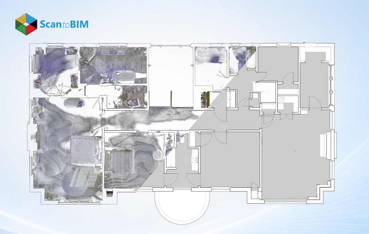
Renovation and retrofit teams work inside buildings that hold decades of hidden changes. Original drawings age, and site conditions drift far from paper records. A laser scan captures the true state of a structure in hours. That scan becomes a cloud of millions of measured points. Converting those points into clean drawings gives architects and engineers a trustworthy starting canvas.
This guide walks through the workflow, the field value, and ten clear benefits for renovation programs. AEC professionals gain a practical reference for scoping their next existing conditions package. Every section stays grounded in real project practice. Renovation managers, drafting leads, and estimators each find useful ground here. The pages ahead treat the topic from a surveyor's perspective on real files.
How Point Cloud to CAD Works
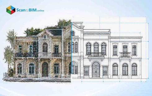
The workflow starts with reality capture. A surveyor sets a terrestrial laser scanner across a series of stations. The scanner emits laser pulses and records up to two million measured points each second. Each point carries X, Y, and Z coordinates that fix its position in space. Together, these points form a spatial replica of the building.
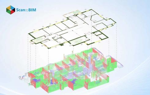
A technician registers the individual scans into one unified dataset. Advanced software such as Autodesk ReCap Pro aligns overlapping stations with shared targets. The clean point cloud is then imported into AutoCAD as a background reference. A drafter traces walls, columns, openings, and floor lines directly over the measured data. Point Cloud to CAD delivers precise 2D plans, sections, and elevations in DWG format.
The output stays pure geometry. A wall appears as parallel lines with a fixed dimension between them. Drafters add layers, annotations, and dimensions to match office standards. The finished DWG file opens in every mainstream drafting platform. This clarity suits permit sets, tenant fit-outs, and coordination drawings. A final quality pass overlays the drawing back onto the cloud for a visual check. This verified DWG then serves the whole design team as a common base.
Why Renovation and Retrofit Projects Require Accurate CAD Documentation
Retrofit programs carry a heavy burden from day one. Old paper drawings usually show the original design intent, and little more. Over the years, site crews made countless small changes on the fly. Most of those tweaks stayed off the record entirely. A team that leans on those stale sheets walks into trouble later. Clashes arise mid-build, the schedule slips, and the budget suffers.
Accurate as-built CAD drawings close that gap over the long term. They show the structure as it actually stands right now, quirks and all. Designers then plan new layouts against geometry they can trust. Estimators price the work based on real quantities, not rough guesses. That kind of certainty guards the schedule and the margin from the very first day.
Industry research confirms the stakes. A widely cited McKinsey study reviewed more than 500 projects. It found cost overruns averaging 79 percent and schedule delays averaging 52 percent. Analysts trace these gaps largely to early planning failures. Verified existing conditions directly address the root cause.
10 Benefits of Point Cloud to CAD for Renovation and Retrofit Projects
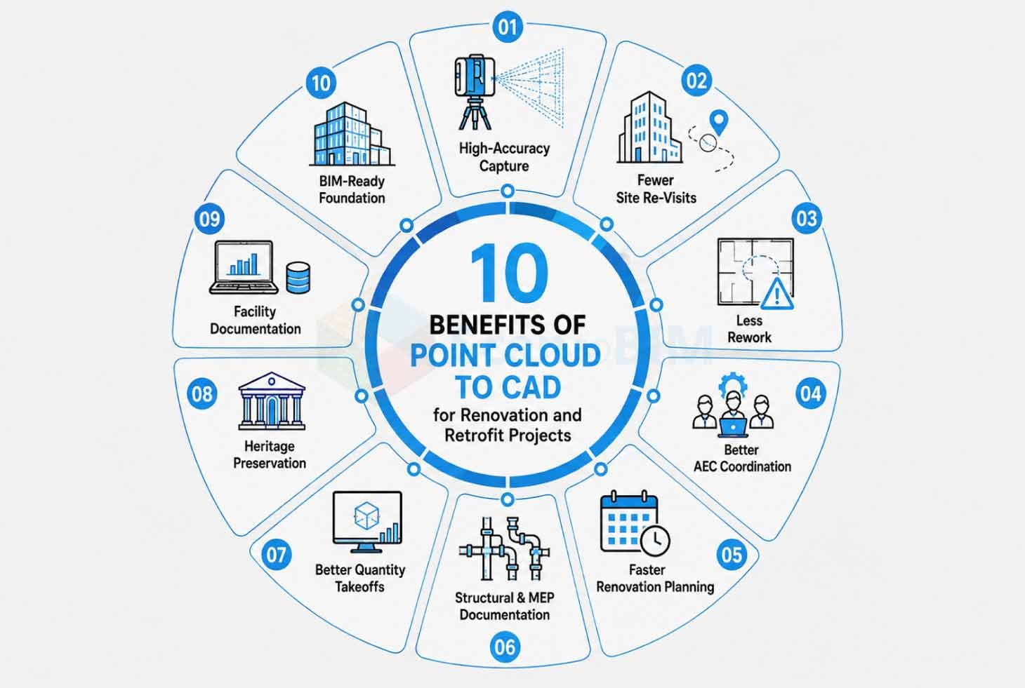
The gains from scan-based drafting turn up at every stage of a retrofit, from first survey to final handover. The ten benefits below reflect what renovation teams actually gain once measured geometry replaces assumptions. Each one ties back to cost, schedule, or design confidence on site.
1. Captures Existing Conditions with High Accuracy
Laser scanners record millimeter-level geometry across an entire floor plate. The drafted output holds that fidelity through to the final drawing. Teams that adopt laser scanning services gain drawings that match reality, wall for wall. Field crews trust every dimension on the sheet. Scanners record floor slopes, wall bows, and settled corners with candid honesty. Drafters carry those true conditions into the plan. This accuracy removes the guesswork that haunts legacy tape surveys.
2. Reduces Costly Site Re-Visits
A single scan session records the whole space at once. Designers pull any measurement later from the point cloud. Teams skip repeated trips back to the building for forgotten dimensions. This saves travel hours and keeps momentum through design development. Remote offices work from the same verified dataset with full confidence.
3. Minimizes Design Errors and Rework
Drafters lay the proposed design straight over the point cloud and catch conflicts early. On one recent fit-out, this overlay flagged a low beam before demolition even started. Reality capture workflows cut rework hard, and one study puts the change order drop near 30 percent (3D Virtual Design Technology). Correct geometry from day one keeps crews building right the first time.
4. Improves Architectural and Engineering Coordination
Here every discipline works from one shared and verified CAD base. Architects, structural engineers, and services teams all draw over the same geometry. That common canvas clears out the version conflicts that plague old paper sets. Coordination meetings then shift toward real design calls, and away from arguments over who measured what. With a single source of truth, every trade stays on the same page from concept through completion.
5. Accelerates Renovation Planning
Fast capture compresses the front end of the project. Teams receive drafted plans in days rather than weeks. Scan to CAD for Renovation Projects move design forward as the building stays fully in use. Quick documentation frees architects to explore options sooner. Faster starts protect tight retrofit calendars. Early plans give owners more time for sound decisions. Rapid turnaround keeps the entire program on track.
6. Supports Structural and MEP Documentation
Scan data picks up beams, columns, ducts, and pipe runs with the same clarity as walls. From that, drafters pull accurate 2D layouts for the structural and services trades. Even a congested plant room turns into a drawing a crew can actually read on site. Exact routing lines then help teams plan new mechanical and electrical work with confidence. On the ground, verified positions spare crews from nasty surprises inside a tight ceiling void. Structural engineers also get to check load paths against member sizes taken from the real building.
7. Improves Quantity Takeoffs and Cost Estimation
Accurate drawings simply lead to accurate quantities. An estimator pulls real areas, lengths, and volumes straight off the CAD file, with far less back-and-forth. Better takeoffs sharpen the material order and cut down on waste. Owners then see a budget built on verified site facts. That openness tends to build trust between the design office and the client early on. Bid packages go out with firm numbers, which keeps the tender free of nasty disputes.
8. Preserves Historic and Heritage Buildings
Heritage buildings hold irregular geometry that a tape measure struggles to pin down. A laser scanner reads ornate profiles and settled, leaning walls with real care. From that data, drafters build faithful CAD records of the protected fabric. Those drawings guide sensitive repair, and conservators keep the original character intact along the way. The scan also leaves behind a permanent digital archive of the building for the years ahead. Since capture stays contactless, the process protects fragile surfaces from any physical touch.
9. Enhances Facility Documentation
The owner walks away with a clean drawing set that matches the building as it truly stands. Down the line, facility teams reach for those accurate plans during maintenance and space planning. Verified layouts also back fit-out changes and help track assets across the whole lifecycle. This living record quietly simplifies every future project inside the property. Over time, that clarity adds real, lasting value to the asset itself.
10. Creates a Trusted Foundation for Future BIM Workflows
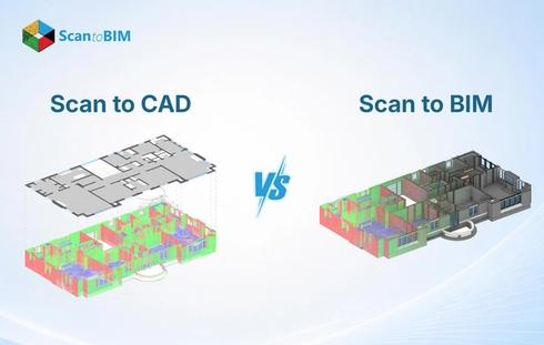
Clean CAD linework forms the ideal springboard toward intelligent modeling. Teams later advance the same scan data into Point Cloud to BIM. The captured cloud supports both drafting and modeling from a single visit. Owners scale their documentation as project needs grow. One dataset supports the entire digital journey.
Taken together, these ten benefits point to a single outcome: fewer unknowns carried into construction. Renovation teams that start from measured geometry spend less time correcting drawings and more time refining the design itself. That advantage compounds across every trade and every phase of the program.
Best Practices for Point Cloud to CAD Projects
Strong results start with a strong capture plan. Surveyors place scan stations to cover every corner with overlap. Good target placement keeps registration tight and clean. Teams agree on the required level of accuracy before the first scan.
- Set clear deliverable standards: layer naming, line weights, and drawing scale stay fixed from the start.
- Register scans to survey control so the drawings sit in true coordinates.
- Trace at consistent cut heights for plans, and hold section lines to the agreed datums.
- Run a QA pass that overlays the finished DWG back onto the point cloud for verification.
Clear scope keeps the drafter focused on the geometry that matters. Teams that follow these steps deliver drawings that experts trust on site with full confidence.
Why Outsource Point Cloud to CAD Conversion?
Drafting a full building from scan data requires skilled hours. In-house teams often stay busy with live design work. Outsourcing Point Cloud to CAD hands the conversion to a dedicated production team. Firms gain finished drawings as their designers stay on billable tasks.
A specialist partner shows up with tuned workflows and steady output quality. Their drafters read heavy scan datasets fast, and they get the geometry right. For a large retrofit program, the firm scales capacity with new staff on board. That approach keeps costs down and protects the delivery date. In the end, owners collect trusted drawings ready for the next design phase.
Conclusion
Renovation success rests on trustworthy information about the existing building. Laser scanning and clean CAD conversion provide that certainty from the very first week. Teams design against real geometry, coordinate cleanly, and price work with confidence. The workflow protects budgets, calendars, and the character of older structures alike.
Accurate existing conditions or building drawings turn a risky retrofit into a controlled project. AEC firms that adopt this practice document faster and build smarter. A single scan visit serves drafting today and modeling tomorrow. The method rewards teams with clarity at every stage of the work.