AEC BIM construction projects often happen within existing buildings where drawings are outdated, incomplete, or unavailable. Facilities undergo layout changes, system replacements, and equipment additions that alter spatial conditions. When design and coordination activities begin without verified geometry, mismatch between drawings and actual site conditions affects planning accuracy. Manual survey methods capture limited data points and introduce cumulative dimensional variation across large or congested spaces. BIM professionals require current, high-resolution spatial information to support coordination across all disciplines. 3D Scan to Revit connects physical space conditions directly with BIM workflows. Creating a reliable technical foundation for renovation, retrofit, and upgrade projects.
Building Information Modeling functions as a collaborative, highly detailed 3D process used for planning, design development, construction coordination, and facility management. When laser scanning data is integrated into BIM, construction information exchange improves across teams and project stages. High-density point clouds provide reliable geometric references that support coordination, validation, and documentation tasks. This integration supports as built modelingby translating verified site conditions into structured BIM elements. Industry case studies across commercial interiors and industrial projects demonstrate positive professional perception and proven project benefits, including improved coordination accuracy and informed decision-making.
Laser Scan to BIM in Commercial and Industrial Construction
Project teams apply Laser Scan to BIM Service across commercial, industrial, and large-scale facilities where accuracy directly affects construction outcomes. Teams use this approach in commercial and industrial facilities that contain complex architectural and MEP systems. Laser scanning allows teams to work within active and occupied buildings without shutdowns, supporting projects that require continuous operations. BIM professionals document existing conditions during renovation, retrofit, tenant fit-out, and industrial upgrade projects before design and coordination activities begin. Experts support construction execution, renovation planning, and building management workflows using verified spatial information. Many owners and contractors now require scan data and BIM models as contractual deliverables particularly for complex facilities and long-term asset management. Project teams align design intent with actual site conditions and support consistent coordination across project phases through commercial scan to BIM services.
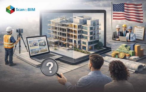
What Is Laser Scan to BIM?
Reality Capture to BIM also called Field to BIM, captures physical site conditions using 3D laser scanning or LiDAR technology. Laser scanners emit laser pulses and record millions of XYZ coordinates that define surface locations in space. These coordinates form a scanned data that represents existing building conditions, including geometry and spatial alignment. BIM teams import this dataset into authoring tools to support point cloud to BIM for construction, where modeling activities follow measured data rather than assumed dimensions. This method supports construction projects that require accurate documentation of complex, built environments.
Core technical components process include:
- 3D laser scanners that emit laser pulses using time-of-flight measurement
- XYZ coordinate data that defines surfaces and edges
- Point clouds capturing geometry, spatial relationships, and surface variation
- Scan registration that aligns multiple scans into one coordinate system
- BIM software such as Revit for model authoring and coordination
BIM specialists interpret registered laser scanned data and create building elements manually based on defined scope, tolerance, and Level of Detail. The scanner captures geometry only for visible surfaces, so occlusions, access limitations, and site conditions directly affect modeling results. Project teams define modeling intent early to control data volume, accuracy targets, and modeled scope. This process supports as-built conditions, coordination checks, and documentation tasks that depend on measured spatial data rather than generalized or outdated drawings.
Why Commercial and Industrial Projects Require Laser Scan to BIM
Commercial and industrial projects often involve existing buildings with undocumented modifications, outdated drawings, or partial records. Renovation and adaptive reuse work frequently begins without reliable documentation which increases uncertainty during planning. Scan to BIM for renovation projectsallows teams to capture accurate existing-condition data before design and coordination start. Traditional manual surveys miss dimensional data, irregular geometry, and concealed elements, especially in facilities with aging infrastructure. Laser scanning records actual geometry at scale, allowing teams to base decisions on measured conditions rather than assumptions.
These environments also contain dense MEP systems that increase coordination risk during renovation or expansion. Industrial facilities often operate under tight shutdown windows, where inaccurate information leads to costly delays. LiDAR to BIM supports early identification of conflicts which is reducing rework during construction. By working with verified as-built conditions, project teams improve planning accuracy, support precise coordination, and manage risk in complex commercial and industrial settings.
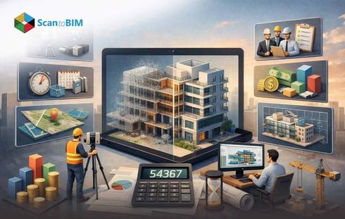
Laser Scan to BIM Workflow for Construction Projects
Phase 1: Project planning phase
The workflow begins by defining scan purpose and project objectives to determine whether the effort supports existing-condition capture, coordination, or as-built documentation. The required Level of Development, accuracy thresholds, and modeling tolerances are established in advance to guide downstream processing and modeling. A pre-scan site assessment evaluates site access constraints, safety requirements, active construction zones, and optimal scanner placement. It is ensuring the scanning strategy aligns with construction logistics and project controls.
Phase 2: On-Site Laser Scanning Execution
Field data capture is performed using tripod-mounted or mobile, eye-safe rotating LiDAR scanners, configured for construction conditions. Scan resolution, point density, and accuracy parameters are set according to the defined requirements. Multiple scan positions and passes are executed to capture complete geometry of structural, architectural, and MEP systems, while mitigating line-of-sight limitations, temporary obstructions, and occlusions caused by equipment or materials present on active sites.
Phase 3: Data Collection, Transfer, and Point Cloud Processing
Captured scan data is stored as raw scan files and transferred to processing environments via USB media or cloud-based platforms. Individual scans are registered into a single, unified point cloud using targets, control points registration methods. The dataset is processed using advanced software such as Revit, Naviswork, Autodesk ReCap. Where noise, temporary construction elements, and scanning artifacts are removed to produce an optimized, construction-ready data.
Phase 4: BIM Model Creation from Point Cloud Data
The registered point cloud is imported into BIM authoring platforms such as Revit to serve as the geometric reference for modeling. Structural, architectural, and MEP elements are manually modeled by BIM specialists according to the defined LOD, accuracy requirements, and project tolerances. Modeled components reflect the scanned conditions rather than assumed or nominal dimensions.
Phase 5: Deliverable Production
The BIM model is evaluated against the dataset to perform design coordination, clash detection, and deviation analysis between modeled elements and constructed conditions. As-built verification confirms installation accuracy relative to design intent and scanned reality. Final construction deliverables including updated BIM models, reality capture output, and coordination or validation reports. These are issued for use by project teams and stakeholders.
Level of Detail (LOD) and Accuracy Requirements

Level of Detail defines how much graphical and non-graphical information each BIM element contains, controlling whether geometry appears generic or highly defined based on project scope. Accuracy requirements define how closely modeled elements match scanned site conditions. Scan registration accuracy must be verified before modeling, and tolerances must align with construction needs and system type. Different building systems require different accuracy levels, especially in commercial and industrial MEP zones. QA notes document modeled scope and tolerances, allowing teams to depend on the model for coordination and execution.
Architectural and MEP Applications of Laser Scan to BIM
- Teams establish verified floor plans, wall locations, slab edges, and ceiling heights when existing drawings lack accuracy.
- Designers reference scan data to model partitions, finishes, and ceiling conditions during renovation and tenant fit-out projects.
- Laser scans capture irregular geometry, surface variation, and alignment conditions for facade retrofit and envelope upgrades.
- Engineers model MEP systems and associated supports directly from measured geometry in MEP zones.
- Laser scan–based models reveal spatial conflicts between architectural, structural, and building services systems before fabrication begins.
- Industrial teams validate equipment layout, access zones, and maintenance clearances, includingscan to BIM for factories and warehouses.
- Project teams plan phased installation and shutdown activities using scan-based spatial analysis.
- Owners receive as-built BIM modeling that support maintenance planning, space utilization, and future facility modifications.
Key Benefits for Commercial and Industrial Construction Teams
Reduced measurement error
Laser scanning replaces manual tape-based surveys with instrument-captured geometry, reducing human measurement error that often accumulates across large construction sites.
Faster data capture and sharing
Teams capture site conditions quickly and distribute point cloud and model data digitally, supporting faster site data capture and information sharing across offices, trades, and stakeholders.
Fewer site visits
Accurate scan data limits the need for repeated field checks, cutting down site revisits and re-measurements during design development and construction coordination.
Conflict identification
Scan aligned BIM models expose installation conflicts before fabrication, lowering rework and overall construction risk.
Stronger cross-discipline coordination
BIM teams coordinate using a shared spatial reference, improving multi-trade alignment in congested zones.
Construction verification and quality control
Teams compare scans against modeled intent to support progress monitoring, installation verification, and quality control during active construction.
Long-term operational value
Owners use scan-based BIM for facility management, maintenance planning, digital twins, and lifecycle documentation, including BIM for retrofit and renovation initiatives.
Heritage protection
Non-contact laser scanning captures irregular geometry and historic details accurately, supporting restoration work where original documentation is missing or unreliable.
Proven industry performance
Case studies research validate measurable reductions in errors, rework, and coordination delays, confirming real-world effectiveness.
Conclusion: Implementing Laser Scan to BIM Successfully
Successful LiDAR to Revit implementation starts with clearly defined project objectives and modeling scope established before field capture begins. Teams align the scanning strategy with downstream modeling and construction use cases, avoiding unnecessary data collection. Early agreement on LOD, deliverables sets realistic expectations and supports predictable outcomes. Skilled professionals, supported by appropriate point cloud processing and BIM authoring tools, convert scan data into usable project intelligence. This structured approach creates a strong technical foundation for commercial and industrial construction execution.