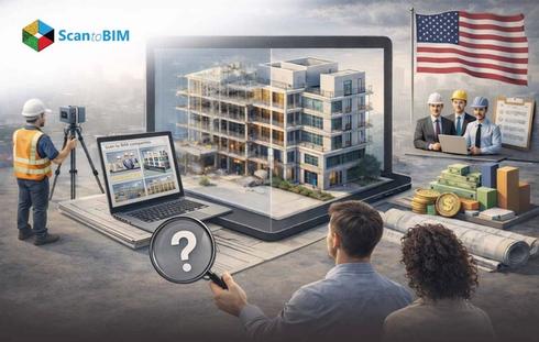
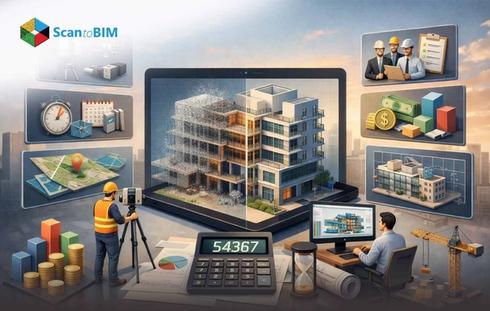
Laser Scanning in Construction and BIM
Laser scanning also known as LiDAR-Light Detection and Ranging, captures high-resolution, three-dimensional spatial data to produce dense point clouds that replicate physical structures. These scanned data are converted into intelligent BIM models that construct information. This enables AEC teams to document, analyze, and manage project. Scan to BIM is valuable for existing buildings that lack digital models, allowing accurate renovation planning, infrastructure maintenance, and lifecycle management.
LiDAR scanning supports clash detection, coordination across disciplines, and validation of design assumptions. It reduces human measurement errors and improves decision-making accuracy. Point clouds form digital twins that provide real-time updates, it enables project stakeholders to track progress, verify construction quality, and assess spatial compliance. Construction teams can extract floor layouts, MEP routing, structural elements, and façade geometry directly from scans, improving construction sequencing, cost estimation, and project scheduling. This workflow accelerates timelines, enhances collaboration, and delivers actionable data throughout design, construction, and operational phases, forming the foundation for data-driven AEC management.
What Is a Laser Scanner and How Does It Work?
BIM uses 3D scanners to capture physical area details and convert them into highly detailed 3D BIM models. The scanner projects laser beams onto surfaces- measures the return time of light pulses, and records millions of spatial points. Laser scanning for existing buildings enables professionals to digitize systems. Even when original drawings are incomplete or outdated. The resulting datasets support renovation, maintenance, facility documentation, and precise construction planning, providing reliable inputs for BIM workflows, clash detection, and digital twin creation.
Processed data produces:
- High-resolution 3D scanned data
- Accurate dimensions for as-built documentation
- CAD drawings and BIM-ready models
- Digital twins for facility management and renovations
- Clash detection and construction verification
Terrestrial Laser Scanners for Construction Projects
Terrestrial 3D laser scanners for construction operate from fixed positions to capture high-density, survey-grade scan for structural verification, infrastructure documentation, and BIM workflows. These systems support industrial surveying, as-built validation, and large-scale construction environments. Where accuracy, range, and stability matter more than mobility. Professionals select terrestrial scanners for long-range capture, angular accuracy, environmental resistance, and direct integration with BIM and point cloud software. BIM Teams also evaluate which systems qualify as the best affordable terrestrial laser scanner for industrial surveying based on scan speed, durability, and software compatibility rather than upfront cost alone.
Leica ScanStation P50
It targets long-range construction and infrastructure scanning where teams must document inaccessible or hazardous areas from safe positions. The scanner reduces field setups by capturing wide areas from a single station, which benefits bridges, high-rise façades, open-pit mines, and large industrial plants. Integration with Cyclone FIELD 360 and Cyclone REGISTER 360 allows on-site registration and office-grade processing. It supports high-fidelity BIM inputs and low-noise data for structural modeling.
| Specification | Data |
|---|---|
| Scan Rate | 1 million points/sec |
| Maximum Range | > 1 km |
| Temperature Range | -20°C to +50°C |
| Protection Rating | IP54 dust and water resistance |
| Imaging | HDR imaging |
| Compensation | Survey-grade dual-axis compensation |
Leica RTC360
Leica RTC360 focuses on fast interior and building-scale reality capture for Scan-to-BIM and as-built digital twin creation. The VIS-based field registration tracks scanner movement and stitches scans without targets, reducing setup time in renovation and retrofit projects. Teams use RTC360 for medium-range building documentation, MEP coordination, and pre-renovation capture where speed and spatial continuity matter more than extreme range.
| Specification | Data |
|---|---|
| 3D Accuracy | 6.4 mm- 50 m, 12.5 mm- 100 m |
| Scan Speed | 2 million pts/sec |
| Range | 40–130 m |
| Temperature Range | -5°C to +40°C |
| Field Registration | Visual Inertial System |
FARO Focus Premium
FARO Focus Premium supports construction-scale scanning where teams need real-time feedback, fast data sharing, and broad software accessibility. Hybrid Reality Capture™ increases capture density, while pre-registered field data improves site decisions before teams leave the location. Integration with FARO Sphere® XG supports cloud-based collaboration and third-party BIM software workflows for large construction sites and public-sector projects.
| Specification | Data |
|---|---|
| Scan Range Options | 100 m / 200 m / 400 m |
| Data Storage | 512 GB onboard SSD |
| Technology | Hybrid Reality Capture™ with Flash Technology™ |
| Field App | FARO Stream™ App |
Teledyne Optech CMS V500
CMS V500 specializes in dangerous and inaccessible cavity scanning, particularly in mining, tunnels, and underground infrastructure. The system allows operators to remain in safe zones while capturing accurate 3D cavity models. Universal export formats support CAD, BIM, and mine planning software, enabling structural comparison, volume analysis, and condition monitoring.
| Specification | Data |
|---|---|
| Field of View | 320° |
| Profile Thickness | 130 mm |
| Operation | Wireless, remote-controlled |
| Imaging | Integrated internal camera |
| Environment | Harsh, wet, dusty underground conditions |
Trimble X9
It supports construction laser scanning technology focused on as-built verification, progress tracking, and construction layout coordination. Automatic calibration and in-field registration reduce post-processing time. While direct georeferencing supports construction control workflows. The system fits projects where teams need consistent accuracy, cloud-based collaboration, and tight integration with Trimble construction ecosystems.
| Specification | Data |
|---|---|
| Angular Accuracy | 16 arc-seconds |
| Calibration | Self-calibrating, self-leveling |
| Integration | Trimble Connect, Trimble FieldLink |
| Field Registration | Automatic in-field alignment |
Mobile and Handheld Laser Scanners for Existing Buildings
Mobile and handheld scanners for existing buildings support Point cloud to Revit workflows where speed, portability, and confined-space access matter more than long-range capture. These systems suit interiors, renovation projects, retrofit planning, facility documentation, and MEP-heavy environments. Professionals use handheld scanners to digitize interior spaces that fixed terrestrial systems cannot efficiently reach. Accuracy depends on operator movement, tracking technology, and sensor type. These tools reduce setup time and allow continuous spatial capture, which improves productivity in operational buildings.
DotProduct DPI-10 / DPI-10SR Kit
DPI-10 targets interior reality capture to bim and documentation workflows that require instant handheld capture and on-tablet validation. Compatibility with Intel RealSense D455 supports daylight scanning, which suits occupied buildings and active sites. Dot3D Pro software enables immediate point cloud review, editing, and export, supporting BIM preparation without office post-processing delays. Accessory kits extend reach into dark spaces, ceilings, and confined zones, making DPI-10 practical for facility surveys and renovation planning.
| Specification | Data |
|---|---|
| Capture Size | Up to 160 million points per scene |
| Sensor Compatibility | PrimeSense, Intel® RealSense™ (D455) |
| Operating Systems | Android, Windows |
| Scanning Mode | Handheld, daylight capable |
| Registration | Semi-automatic via April Tags |
| Range Options | Short: 1–6 ft / Long: 2–12 ft |
FARO Freestyle 2
FARO Freestyle 2 supports photorealistic interior reality capture where teams must document confined rooms, mechanical spaces, and complex geometry. Real-time visualization and haptic feedback guide scanning technique during capture, reducing data gaps. On-site compensation and white balancing allow field-ready datasets for BIM preparation. The scanner suits as-built verification, renovation documentation, and interior coordination where portability and visual clarity matter.
| Specification | Data |
|---|---|
| Range | 0.4–5 m (up to 10 m limited) |
| 3D Point Accuracy | ≤0.5 mm |
| Acquisition Rate | Up to 220,000 points/sec |
| Weight | 1.48 kg |
| IP Rating | IP52 |
| Operating Temperature | 0–40°C |
Artec Eva
Artec Eva uses structured-light technology for high-resolution object and component capture rather than full building geometry. BIM teams apply Eva for equipment modeling, façade elements, custom components, and retrofit parts that require fine geometric detail. The scanner performs well on dark and reflective surfaces, supporting accurate modeling of mechanical assemblies and architectural features for BIM libraries and fabrication workflows.
| Specification | Data |
|---|---|
| Capture Speed | 16 FPS |
| Processing Rate | Up to 18 million points/sec |
| Accuracy | Up to 0.1 mm |
| 3D Resolution | 0.2 mm |
| Texture Resolution | 1.3 MP |
FARO Orbis
It combines mobile SLAM scanning with terrestrial-grade accuracy, enabling up to ten times faster data acquisition than static methods. The system suits industrial facilities, interiors, and multi-floor buildings where teams need speed without sacrificing data quality. FARO Flash technology supports consistent point density, feeding BIM workflows that require both coverage and accuracy.
| Specification | Data |
|---|---|
| Maximum Reach | 120 m |
| Scan Rate | 640,000 points/sec |
| Technology | Mobile SLAM + FARO Flash Technology™ |
| Price | ~ €48,458 |
Metaroom® Scan App
Metaroom® Scan App provides LiDAR-based mobile scanning using Apple devices, targeting rapid interior digitization rather than survey-grade capture. Users scan rooms, floors, or entire buildings room-by-room, with automatic merging into a unified 3D model. Cloud processing converts scans into CAD-ready outputs, which users enrich and export from Metaroom® Workspace. The solution fits early-stage planning, space documentation, and cost-efficient Scan-to-BIM preparation where speed and accessibility matter.
| Specification | Data |
|---|---|
| Maximum Reach | 5 m |
| Scan Rate | Real-time detection |
| Supported Devices | iPhone 12 Pro+, iPad Pro (2020+) |
| App Price | Free |
| Workspace Price | From €9.90/month |
Aerial Laser Scanning and Drone-Based LiDAR
Aerial laser scanning using drone-mounted LiDAR 3D laser scanners allow capture areas from an elevated perspective. UAVs equipped with LiDAR sensors emit pulsed laser beams recording millions of points to generate accurate 3D point clouds. This method is effective for surveying rooftops, tall façades, infrastructure corridors, and expansive construction sites. Drone-based LiDAR complements terrestrial and mobile scanning by filling data gaps and supporting 3D scan to Revit workflows. It provides site context for planning, earthworks, and infrastructure modeling.
Components and Technology:
- UAV platform designed for stable, automated flight
- LiDAR sensor measuring distances via laser pulse reflection
- GNSS/GPS and IMU for precise georeferencing
- Processing software for point cloud registration and BIM integration
Advantages
- Safe access to hazardous or elevated locations
- Rapid coverage of large or remote areas
- High-quality data for topography, as-built documentation, and planning
- Export to CAD and BIM platforms
- Reduced need for scaffolding or manual access equipment
Despite its high efficiency, drone-based LiDAR performance can be affected by weather conditions, and visibility. It requires trained operators and regulatory compliance. While it offers broader coverage than terrestrial scanners. It is combined with ground-based methods to achieve BIM-ready accuracy, making aerial LiDAR a component of modern, multi-source 3D laser scan to BIM strategies.
Choosing the Right Laser Scanner for BIM and As-Built Documentation
BIM Project requires Choosing the right Laser scanners based on small-large scale Project, requirement, and site conditions. TLS are best for projects requiring millimeter-level precision, such as industrial and infrastructure as-builts. Handheld scanners suit interiors and confined spaces. while mobile scanners enable fast coverage of large areas. Aerial LiDAR is ideal for site-wide and elevated structures. Compatibility with BIM software supports workflows and as-built documentation.
Laser Scanner Accuracy, Range, and Data Output Considerations
| Scanner Type | Typical Accuracy | Effective Range | Data Output |
|---|---|---|---|
| Handheld Scanners | ≤ 0.5 mm | 0.4–10 m | Colorized data, detailed interior geometry, CAD/BIM-ready meshes |
| Mobile SLAM Scanners | 5–15 mm | Up to 120 m | Large-scale Mesh data, fast as-built capture, registered SLAM datasets |
| App-Based LiDAR | Room-level accuracy | Up to 5 m | CAD ready models, BIM compatible exports, floor plans |
| TLS Scanner | Millimeter-level precision | Long-range | High-density information, engineering-grade as-built data |
| Aerial LiDAR | Centimeter-level | Large-area coverage | Georeferenced point clouds, terrain models, BIM site context |
Construction laser scanning technology higher accuracy supports detailed as-built documentation, while greater range enables site-wide capture. Choosing the right balance enables efficient construction workflows, BIM integration, and reduced remodeling across construction projects.
Conclusion
Successful laser scanning depends on aligning capture methods, data density, and output formats with BIM workflows. Each laser scanner contributes different data layers that support modeling, verification, and coordination at specific project stages. These technologies produce structured point cloud datasets that translate into usable BIM intelligence. It supports as-built validation, renovation planning, and asset documentation across the full building lifecycle.